WISE EIONET Spatial Datasets - PUBLIC VERSION - version 1.6, Mar. 2022
The dataset contains information on European groundwater bodies, monitoring sites, river basin districts, river basin districts sub-units and surface bodies reported to the European Environment Agency between 29-11-2001 and 24-03-2022.
The information was reported to the European Environment Agency under the State of Environment reporting obligations.
For the EU27 countries, Iceland, Norway and the United Kingdom, the EIONET spatial data was consolidated with the spatial data reported under the Water Framework Directive reporting obligations. For these countries, the reference spatial data set is the "WISE WFD Reference Spatial Datasets reported under Water Framework Directive".
Relevant concepts:
Groundwater body: 'Body of groundwater' means a distinct volume of groundwater within an aquifer or aquifers.
Groundwater: All water which is below the surface of the ground in the saturation zone and in direct contact with the ground or subsoil.
Aquifer: Subsurface layer or layers of rock or other geological strata of sufficient porosity and permeability to allow either a significant flow of groundwater or the abstraction of significant quantities of groundwater.
Surface water body: Body of surface water means a discrete and significant element of surface water such as a lake, a reservoir, a stream, river or canal, part of a stream, river or canal, a transitional water or a stretch of coastal water.
Surface water: Inland waters, except groundwater; transitional waters and coastal waters, except in respect of chemical status for which it shall also include territorial waters.
Inland water: All standing or flowing water on the surface of the land, and all groundwater on the landward side of the baseline from which the breadth of territorial waters is measured.
River: Body of inland water flowing for the most part on the surface of the land but which may flow underground for part of its course.
Lake: Body of standing inland surface water.
River basin district: The area of land and sea, made up of one or more neighbouring river basins together with their associated groundwaters and coastal waters, which is the main unit for management of river basins.
River basin: The area of land from which all surface run-off flows through a sequence of streams, rivers and, possibly, lakes into the sea at a single river mouth, estuary or delta.
Sub-basin: The area of land from which all surface run-off flows through a series of streams, rivers and, possibly, lakes to a particular point in a water course (normally a lake or a river confluence).
Sub-unit [Operational definition. Not in the WFD]: Reporting unit. River basin districts larger than 50000 square kilometre should be divided into comparable sub-units with an area between 5000 and 50000 square kilometre. The sub-units should be created using river basins (if more than one river basin exists in the RBD), set of contiguous river basins, or sub-basins, for example. If the RBD area is less than 50000 square kilometre, the RBD itself should be used as a sub-unit.
Simple
- Date (Creation)
- 2018-09-15
- Date (Revision)
- 2022-03-24
- Date (Publication)
- 2022-03-24
- Edition
-
01.06
- Identifier
- eea_v_4326_250_k_wise-eionet_p_2001-2022_v01_r06
- Identifier
- DAT-204-en
Point of contact
Point of contact
- Maintenance and update frequency
- As needed
-
GEMET - INSPIRE themes, version 1.0
-
-
Area management/restriction/regulation zones and reporting units
-
Environmental monitoring facilities
-
-
WISE metadata keywords, version 1.0, 2009-10-01
-
-
Water Information System for Europe (WISE)
-
Groundwater body
-
Water body
-
Surface water
-
Surface water body
-
Monitoring station
-
River basin district
-
Sub unit
-
- Keywords
-
-
GEMET
-
-
groundwater
-
water body
-
monitoring station
-
water resources management
-
surface water
-
water (geographic)
-
aquifer
-
-
Continents, countries, sea regions of the world.
-
-
EEA38 (from 2020)
-
United Kingdom
-
-
INSPIRE - Feature Concept Dictionary, version 3
-
-
River Basin
-
Surface Water
-
-
EEA topics
-
-
Water
-
-
EEA Management Plan
-
-
2022 1.1.2
-
- Access constraints
- Other restrictions
- Other constraints
- no limitations to public access
- Use constraints
- Other restrictions
- Other constraints
-
EEA standard re-use policy: unless otherwise indicated, re-use of content on the EEA website for commercial or non-commercial purposes is permitted free of charge, provided that the source is acknowledged ( http://www.eea.europa.eu/legal/copyright ). Copyright holder: European Environment Agency (EEA).
- Aggregate Datasetindentifier
- e14d401a-b183-4b70-a7c8-950537d2e390
- Association Type
- revisionOf
- Spatial representation type
- Vector
- Denominator
- 250000
- Metadata language
- English
- Character set
- UTF8
- Topic category
-
- Environment
- Inland waters
- Geoscientific information
))
- Begin date
- 2001-11-29
- End date
- 2022-03-24
- Unique resource identifier
- EPSG:4326
- Distribution format
-
-
SHP
(
1
)
-
Geopackage
(
)
-
SHP
(
1
)
OnLine resource
- OnLine resource
- Direct download ( WWW:URL )
- OnLine resource
- EIONET monitoring sites - Web Service ( WWW:LINK-1.0-http--link )
- OnLine resource
- EIONET groundwater bodies - Web Service ( WWW:LINK-1.0-http--link )
- OnLine resource
- EIONET monitoring sites - Web Service ( WWW:LINK-1.0-http--link )
- OnLine resource
- EIONET groundwater bodies - Web Service ( WWW:LINK-1.0-http--link )
- Hierarchy level
- Dataset
Conformance result
- Date (Publication)
- 2010-12-08
- Explanation
-
See the referenced specification
- Statement
-
1) Data model
The data set follows the WISE spatial data model described in the WISE GIS guidance, available at https://cdr.eionet.europa.eu/help/WFD/WFD_780_2022/GISGuidance/WISE_GIS_Guidance.pdf
The formal XSD schemas are available at https://dd.eionet.europa.eu/schemaset/WFD20 22
The formal UML model is available at https://cdr.eionet.europa.eu/help/WFD/WFD_780_2022/UML%20Data%20specification/WFD2022.EAP
Refer to the WISE GIS guidance for the mapping between the GML elements in the XML schema and the corresponding fields in Shapefile format.
Some additional fields are present in the shapefiles: cYear, country, lat, lon, statusCode, statusDate, remarks and qcCheck.
cYear: Integer field containing the value 2013 for the objects that have never been reported in WISE-5
country:Two-letter ISO code of the country (ISO 3166 alpha-2), except for Greece and the United Kingdom, for which the abbreviations EL and UK are used.
lat: Latitude, in decimal degrees, of an arbitrary point located within the geometry of the object (if available)
lon: Longitude, in decimal degrees, of an arbitrary point located within the geometry of the object (if available)
statusCode: Status code of the thematic identifier in the WISE register (refer to Status for further information).
statusDate: Date of reference for the status code (typically the date when the data was extracted for publication).
remarks:Additional information about the status code of the superseding object, if any.
qcCheck:Additional information about checks performed in the data.
2) Data sources
Information reported until 2013 was compiled by the European Topic Centre on Inland, Coastal and Marine waters. The legacy records can be selected using the criteria cYear = 2013.
Additional information was reported under the "WISE - Spatial Data (WISE-5)" data flow. See https://rod.eionet.europa.eu/obligations/806 and http://rod.eionet.europa.eu/obligations/716 for further information on the reporting.
For the EU27 countries, Iceland, Norway and the United Kingdom, the EIONET data was consolidated with the full national datasets reported under the "Water Framework Directive - River Basin Management Plans - 2016 Spatial data" (hereafter WFD2016). See http://rod.eionet.europa.eu/obligations/717 for further information on the reporting.
3) Data processing
The EIONET data were updated using data reported in WFD2016, whenever the spatial objects could be matched.
For EIONET objects, some information may be missing, if the objects have not been reported since 2013. Objects that no longer exist or were replaced have wiseEvolutionType = 'deletion'.
4) Data quality
THIS DATASET DOES NOT FULLY COMPLY WITH THE WISE SPATIAL DATA MODEL SPECIFICATION.
The reason for non-compliance is that not all the information required by the WISE spatial data model is available for the legacy data reported before 2013.
The geometry of the objects was obtained from the spatial data files, where available. A conventional geometry was included for the objects for which only the location of the representative point was available.
Traceability from a spatial object in the dataset to a specific data element and data file in a Central Data Repository delivery is not possible.
No geometric or topological error correction was performed.
Basic automated editing of string values (upper-casing, trimming, removal of invalid characters or values) was performed.
The compliance of the identifiers of the spatial objects with the requirements of the WISE-5 model was verified.
Thematic identifiers must start with the ISO 3166-1 alpha-2 country code, except for Greece ('EL') and the United Kingdom ('UK').
Thematic identifiers must comply with the following Regex pattern: ^[A-Z]{2}[0-9A-Z]{1}([0-9A-Z_-]{0,38}[0-9A-Z]{1}){0,1}$
A valid identifier was proposed for each invalid identifier. The changes can be traced via the WISE registers.
5) WISE registers
For river basin districts and sub-units, the register of WISE thematic identifiers is kept in http://dd.eionet.europa.eu/vocabulary/wise/SpatialUnit
For surface water bodies and groundwater bodies, the register of WISE thematic identifiers is kept in http://dd.eionet.europa.eu/vocabulary/wise/WaterBody
For monitoring sites, the register of WISE thematic identifiers is kept in http://dd.eionet.europa.eu/vocabulary/wise/MonitoringSite
- File identifier
- 5a23b24d-558f-4fa9-90cb-6f94e688a483 XML
- Metadata language
- English
- Character set
- UTF8
- Hierarchy level
- Dataset
- Date stamp
- 2023-10-20T13:07:07
- Metadata standard name
-
ISO 19115/19139
- Metadata standard version
-
1.0
Overviews
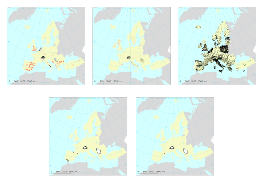
Spatial extent
Provided by
