 Stars4Water
WISE - Global Soil Profile Data, version 3.1
Version 3.1 of the ISRIC-WISE database (WISE3) was compiled from a wide range of soil profile data collected by many soil professionals worldwide. All profiles have been harmonized with respect to the original Legend (1974) and Revised Legend (1988) of FAO-Unesco. Thereby, the primary soil data ─ and any secondary data derived from them ─ can be linked using GIS to the spatial units of the digitized Soil Map of the World as well as more recent digital Soil and Terrain (SOTER) databases through the soil legend code.
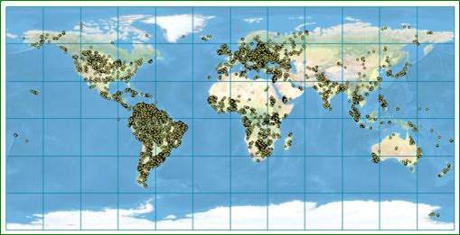
WISE3 holds selected attribute data for some 10,250 soil profiles, with some 47,800 horizons, from 149 countries. Individual profiles have been sampled, described, and analyzed according to methods and standards in use in the originating countries. There is no uniform set of properties for which all profiles have analytical data, generally because only selected measurements were planned during the original surveys. Methods used for laboratory determinations of specific soil properties vary between laboratories and over time; sometimes, results for the same property cannot be compared directly. WISE3 will inevitably include gaps, being a compilation of legacy soil data derived from traditional soil survey, which can be of a taxonomic, geographic, and soil analytical nature. As a result, the amount of data available for modelling is sometimes much less than expected. Adroit use of the data, however, will permit a wide range of agricultural and environmental applications at a global and continental scale (1:500 000 and broader).
Preferred citation:
Batjes NH 2009. Harmonized soil profile data for applications at global and continental scales: updates to the WISE database. Soil Use and Management 5:124–127, http://dx.doi.org/10.1111/j.1475-2743.2009.00202.x
Simple
- Date (Publication)
- 2008-12-01
- Identifier
- a351682c-330a-4995-a5a1-57ad160e621c
- Presentation form
- Digital map
- Status
- Completed
- Theme
-
-
calcium
-
carbon
-
cation exchange capacity
-
electrical conductivity
-
nitrogen
-
organic carbon
-
bulk density
-
soil classification
-
soil depth
-
soil profiles
-
pH
-
salinity
-
texture
-
water holding capacity
-
soil profiles
-
nutrients
-
-
Stratum
-
-
Soil science
-
-
Region
-
-
Global
-
- Access constraints
- License
- Use constraints
- License
- Other constraints
- Attribution 3.0 International (CC BY 3.0)
- Spatial representation type
- Vector
- Denominator
- 100000
- Metadata language
- English
- Character set
- UTF8
- Topic category
-
- Geoscientific information
- Begin date
- 1925-01-01
- End date
- 2010-04-15
))
- Reference system identifier
- EPSG / 4326
- Distribution format
-
-
zip
(
)
-
Niels Batjes
(
)
-
zip
(
)
- OnLine resource
- Download ( WWW:DOWNLOAD-1.0-ftp--download )
- OnLine resource
- Project webpage ( WWW:LINK-1.0-http--related )
- OnLine resource
- Report ( WWW:LINK-1.0-http--related )
- Hierarchy level
- Dataset
- Statement
-
Journal paper:
1)Batjes NH 2009. Harmonized soil profile data for applications at global and continental scales: updates to the WISE database. Soil Use and Management 5:124–127,
http://dx.doi.org/10.1111/j.1475-2743.2009.00202.x
Supporting documentation:
2) Batjes NH 2008. ISRIC-WISE Harmonized Global Soil Profile Dataset (Ver. 3.1). Report 2008/02, ISRIC – World Soil Information, Wageningen, 59p with dataset, https://isric.org/sites/default/files/isric_report_2008_02.pdf
- File identifier
- a351682c-330a-4995-a5a1-57ad160e621c XML
- Metadata language
- English
- Character set
- UTF8
- Hierarchy level
- Dataset
- Hierarchy level name
-
dataset
- Date stamp
- 2025-02-05T10:33:43
- Metadata standard name
-
ISO 19115:2003/19139
- Metadata standard version
-
2003/Cor.1:2006
Overviews
Spatial extent
Provided by
