 Stars4Water
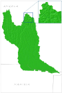
flow direction
Type of resources
Available actions
Topics
Keywords
Contact for the resource
Provided by
Representation types
Update frequencies
status
-
This raster layer (90m resolution) represents the flow accumulation in the CORB-Contributing area. This raster was created by interpolating the Flow Direction raster grid to discern the accumulated number of cells with flow direction upstream of a cell, for each cell in the input grid. This dataset is part of the GIS Database for the Environment Protection and Sustainable Management of the Okavango River Basin project (EPSMO). Detailed information on the database can be found in the “GIS Database for the EPSMO Project†document produced by Luis Veríssimo (FAO consultant) in July 2009, and here available for download.
-

This raster layer (90m resolution) represents the flow direction in the CORB-Contributing area. The values in the cells of the grid indicate the direction of flow from that cell. This layer was created from the SRTM DTM (digital terrain model). In order to eliminate error, a “Fill Sinks†function was conducted on the SRTM DTM of the basin prior to the creation of this layer. Source: SRTM DTM (digital terrain model). This dataset is part of the GIS Database for the Environment Protection and Sustainable Management of the Okavango River Basin project (EPSMO). Detailed information on the database can be found in the “GIS Database for the EPSMO Project†document produced by Luis Veríssimo (FAO consultant) in July 2009, and here available for download.