 Stars4Water
geoscientificInformation
Type of resources
Available actions
Topics
Keywords
Contact for the resource
Provided by
Years
Formats
Representation types
Update frequencies
status
Scale
Resolution
-
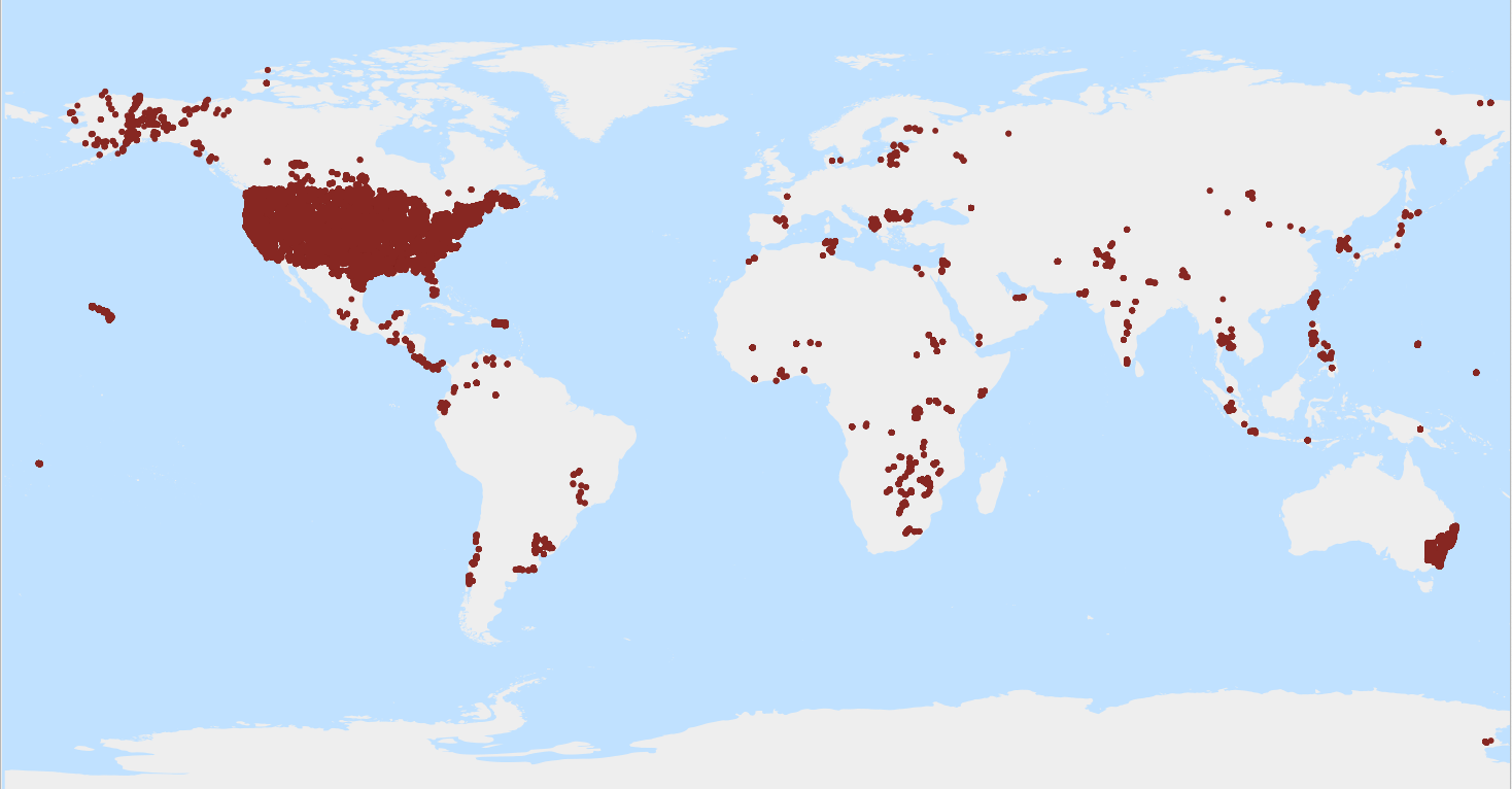
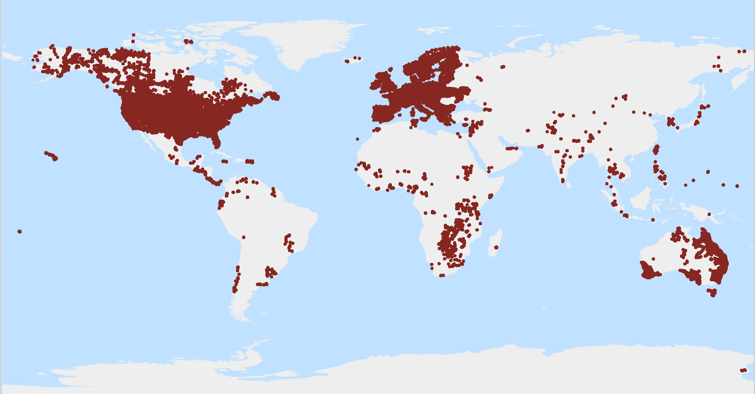
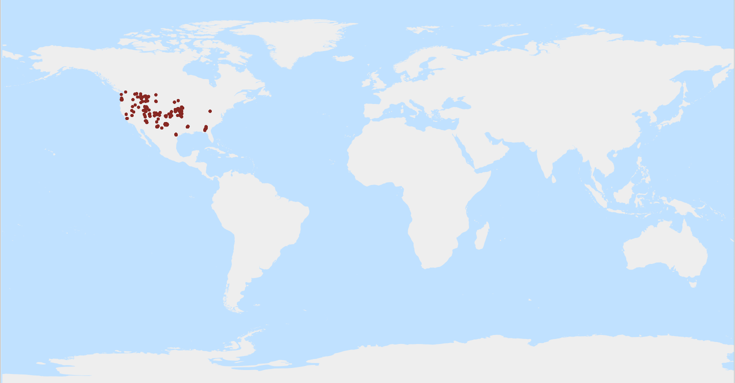
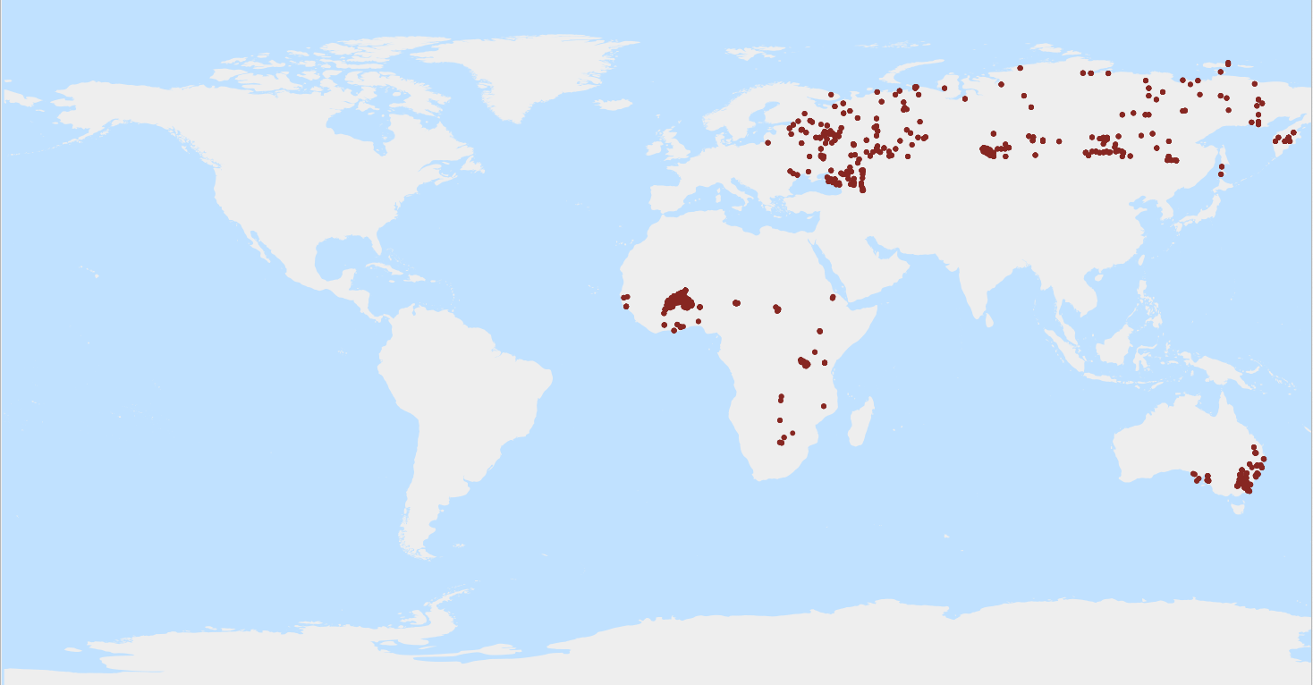
Soil moisture content by weight, at tension 33 kPa (pF 2.5) (g/100g). WoSIS_latest is a 'dynamic dataset' that contains the most recent complement of quality-assessed and standardised soil data served from WoSIS (ISRIC World Soil Information Service). The source data were shared by a wide range of data providers (see: https://www.isric.org/explore/wosis/wosis-contributing-institutions-and-experts). Being dynamic, the contents of 'wosis_latest' will change once new point data are acquired, cleansed and standardised, additional soil properties are considered, and/or when possible amendments are required. Static snapshots of 'wosis_latest' are released at irregular intervals for consistent citation purposes and to discuss methodological changes; the last snapshot is available at https://doi.org/10.5194/essd-16-4735-2024. For general information about WoSIS please see the FAQ-page at https://www.isric.org/explore/wosis/faq-wosis.
-

Bulk density of the whole soil including coarse fragments, air dried (kg/dm³). WoSIS_latest is a 'dynamic dataset' that contains the most recent complement of quality-assessed and standardised soil data served from WoSIS (ISRIC World Soil Information Service). The source data were shared by a wide range of data providers (see: https://www.isric.org/explore/wosis/wosis-contributing-institutions-and-experts). Being dynamic, the contents of 'wosis_latest' will change once new point data are acquired, cleansed and standardised, additional soil properties are considered, and/or when possible amendments are required. Static snapshots of 'wosis_latest' are released at irregular intervals for consistent citation purposes and to discuss methodological changes; the last snapshot is available at https://doi.org/10.5194/essd-16-4735-2024. For general information about WoSIS please see the FAQ-page at https://www.isric.org/explore/wosis/faq-wosis.
-
Soil moisture content by volume, at tension 500 kPa (pF 3.7) (cm³/100cm³). WoSIS_latest is a 'dynamic dataset' that contains the most recent complement of quality-assessed and standardised soil data served from WoSIS (ISRIC World Soil Information Service). The source data were shared by a wide range of data providers (see: https://www.isric.org/explore/wosis/wosis-contributing-institutions-and-experts). Being dynamic, the contents of 'wosis_latest' will change once new point data are acquired, cleansed and standardised, additional soil properties are considered, and/or when possible amendments are required. Static snapshots of 'wosis_latest' are released at irregular intervals for consistent citation purposes and to discuss methodological changes; the last snapshot is available at https://doi.org/10.5194/essd-16-4735-2024. For general information about WoSIS please see the FAQ-page at https://www.isric.org/explore/wosis/faq-wosis.
-
%20-%20Bray%20I.png)
Measured according to the Bray-I method, a combination of HCl and NH4 F to remove easily acid soluble P forms, largely Al- and Fe-phosphates (for acid soils) (mg/kg). WoSIS_latest is a 'dynamic dataset' that contains the most recent complement of quality-assessed and standardised soil data served from WoSIS (ISRIC World Soil Information Service). The source data were shared by a wide range of data providers (see: https://www.isric.org/explore/wosis/wosis-contributing-institutions-and-experts). Being dynamic, the contents of 'wosis_latest' will change once new point data are acquired, cleansed and standardised, additional soil properties are considered, and/or when possible amendments are required. Static snapshots of 'wosis_latest' are released at irregular intervals for consistent citation purposes and to discuss methodological changes; the last snapshot is available at https://doi.org/10.5194/essd-16-4735-2024. For general information about WoSIS please see the FAQ-page at https://www.isric.org/explore/wosis/faq-wosis.
-
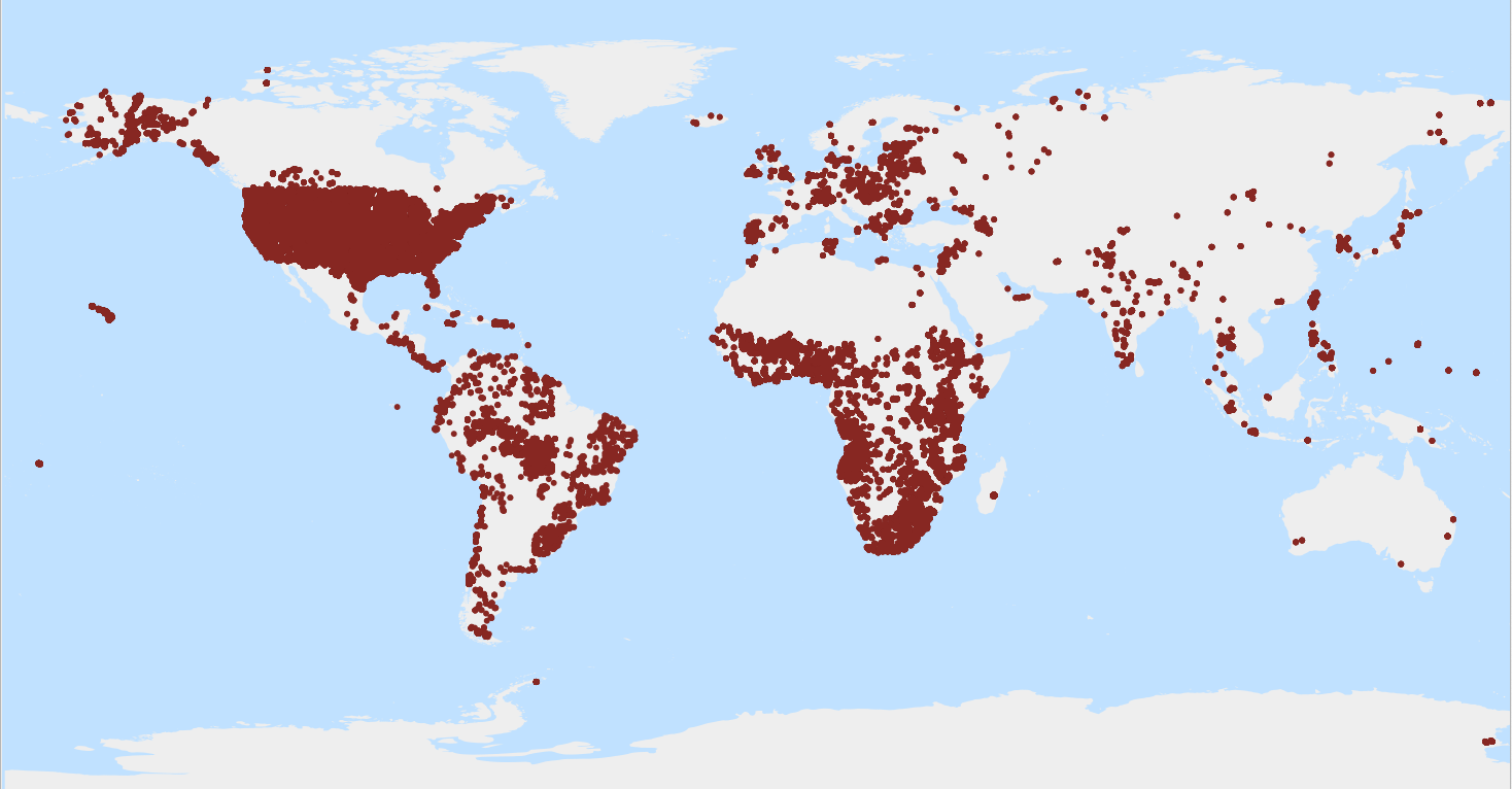
Volumetric content of coarse fragments* in the whole soil (cm³/100cm³). WoSIS_latest is a 'dynamic dataset' that contains the most recent complement of quality-assessed and standardised soil data served from WoSIS (ISRIC World Soil Information Service). The source data were shared by a wide range of data providers (see: https://www.isric.org/explore/wosis/wosis-contributing-institutions-and-experts). Being dynamic, the contents of 'wosis_latest' will change once new point data are acquired, cleansed and standardised, additional soil properties are considered, and/or when possible amendments are required. Static snapshots of 'wosis_latest' are released at irregular intervals for consistent citation purposes and to discuss methodological changes; the last snapshot is available at https://doi.org/10.5194/essd-16-4735-2024. For general information about WoSIS please see the FAQ-page at https://www.isric.org/explore/wosis/faq-wosis.
-
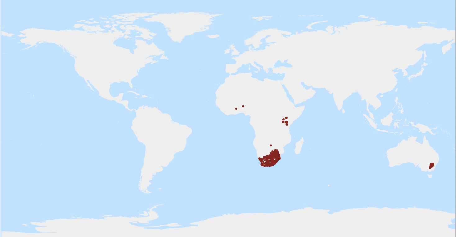
The content of carbonate in a liming material or calcareous soil calculated as if all of the carbonate is in the form of CaCO3 (in the fine earth fraction*); also known as inorganic carbon (g/kg). WoSIS_latest is a 'dynamic dataset' that contains the most recent complement of quality-assessed and standardised soil data served from WoSIS (ISRIC World Soil Information Service). The source data were shared by a wide range of data providers (see: https://www.isric.org/explore/wosis/wosis-contributing-institutions-and-experts). Being dynamic, the contents of 'wosis_latest' will change once new point data are acquired, cleansed and standardised, additional soil properties are considered, and/or when possible amendments are required. Static snapshots of 'wosis_latest' are released at irregular intervals for consistent citation purposes and to discuss methodological changes; the last snapshot is available at https://doi.org/10.5194/essd-16-4735-2024. For general information about WoSIS please see the FAQ-page at https://www.isric.org/explore/wosis/faq-wosis.
-
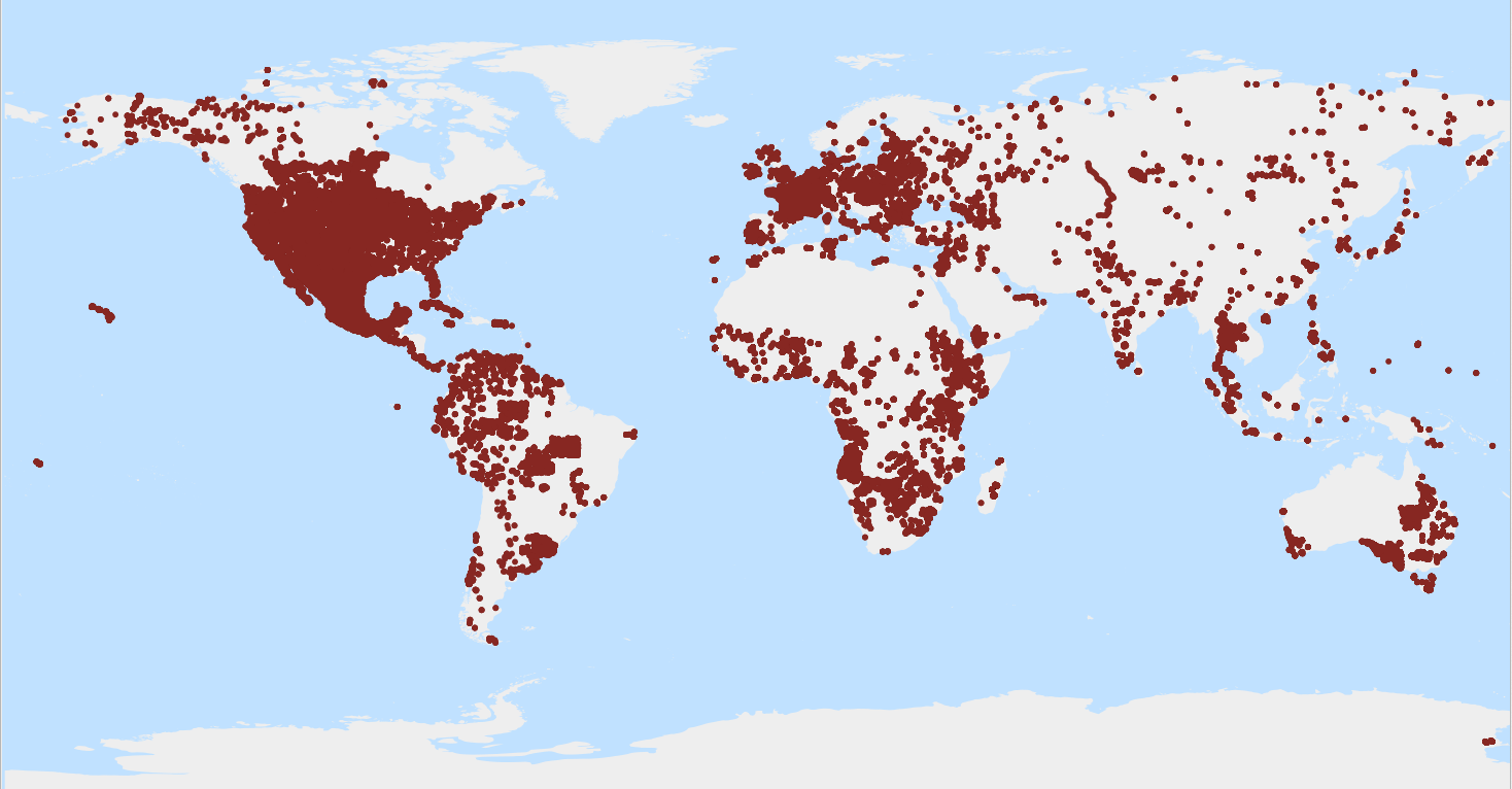
A measure of the acidity or alkalinity in soils, defined as the negative logarithm (base 10) of the activity of hydronium ions (H+) in a CaCl2 solution, as specified in the analytical method descriptions. WoSIS_latest is a 'dynamic dataset' that contains the most recent complement of quality-assessed and standardised soil data served from WoSIS (ISRIC World Soil Information Service). The source data were shared by a wide range of data providers (see: https://www.isric.org/explore/wosis/wosis-contributing-institutions-and-experts). Being dynamic, the contents of 'wosis_latest' will change once new point data are acquired, cleansed and standardised, additional soil properties are considered, and/or when possible amendments are required. Static snapshots of 'wosis_latest' are released at irregular intervals for consistent citation purposes and to discuss methodological changes; the last snapshot is available at https://doi.org/10.5194/essd-16-4735-2024. For general information about WoSIS please see the FAQ-page at https://www.isric.org/explore/wosis/faq-wosis.
-
Soil moisture content by weight, at tension 500 kPa (pF 3.7) (g/100g). WoSIS_latest is a 'dynamic dataset' that contains the most recent complement of quality-assessed and standardised soil data served from WoSIS (ISRIC World Soil Information Service). The source data were shared by a wide range of data providers (see: https://www.isric.org/explore/wosis/wosis-contributing-institutions-and-experts). Being dynamic, the contents of 'wosis_latest' will change once new point data are acquired, cleansed and standardised, additional soil properties are considered, and/or when possible amendments are required. Static snapshots of 'wosis_latest' are released at irregular intervals for consistent citation purposes and to discuss methodological changes; the last snapshot is available at https://doi.org/10.5194/essd-16-4735-2024. For general information about WoSIS please see the FAQ-page at https://www.isric.org/explore/wosis/faq-wosis.
-

Soil moisture content by weight, at tension 1500 kPa (pF 4.2) (g/100g). WoSIS_latest is a 'dynamic dataset' that contains the most recent complement of quality-assessed and standardised soil data served from WoSIS (ISRIC World Soil Information Service). The source data were shared by a wide range of data providers (see: https://www.isric.org/explore/wosis/wosis-contributing-institutions-and-experts). Being dynamic, the contents of 'wosis_latest' will change once new point data are acquired, cleansed and standardised, additional soil properties are considered, and/or when possible amendments are required. Static snapshots of 'wosis_latest' are released at irregular intervals for consistent citation purposes and to discuss methodological changes; the last snapshot is available at https://doi.org/10.5194/essd-16-4735-2024. For general information about WoSIS please see the FAQ-page at https://www.isric.org/explore/wosis/faq-wosis.
-
Soil moisture content by volume, at tension 100 kPa (pF 3.0) (cm³/100cm³). WoSIS_latest is a 'dynamic dataset' that contains the most recent complement of quality-assessed and standardised soil data served from WoSIS (ISRIC World Soil Information Service). The source data were shared by a wide range of data providers (see: https://www.isric.org/explore/wosis/wosis-contributing-institutions-and-experts). Being dynamic, the contents of 'wosis_latest' will change once new point data are acquired, cleansed and standardised, additional soil properties are considered, and/or when possible amendments are required. Static snapshots of 'wosis_latest' are released at irregular intervals for consistent citation purposes and to discuss methodological changes; the last snapshot is available at https://doi.org/10.5194/essd-16-4735-2024. For general information about WoSIS please see the FAQ-page at https://www.isric.org/explore/wosis/faq-wosis.