 Stars4Water
2019
Type of resources
Available actions
Topics
Keywords
Contact for the resource
Provided by
Years
Formats
Representation types
Update frequencies
status
Resolution
-
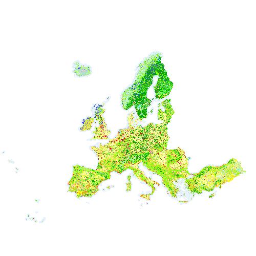
The World Settlement Footprint (WSF) 2019 is a 10m resolution binary mask outlining the extent of human settlements globally
-
IMERG (Integrated MultisatellitE Retrievals from GPM) precipitation product was developed by NASA in collaboration with JAXA
-
ASTER GDEM was generated using stereo-pair images collected by the ASTER instrument onboard Terra. Resolution is 30m. ASTER GDEM coverage spans from 83 degrees north latitude to 83 degrees south, encompassing 99 percent of Earth's landmass.
-
CMORPH (Climate Prediction Center Morphing Technique) generates global precipitation products based on PMW and IR with 8 km spatial and 0.5-hourly temporal resolution. An archive is available from 1988 until present.
-

GSOCmap is the first global soil organic carbon map ever produced through a consultative and participatory process involving member countries, which makes this map totally new and unique. In fact, the map was prepared by member countries, under the guidance of the Intergovernmental Technical Panel on Soils and the Global Soil Partnership Secretariat. Countries agreed on the methodology to produce the map and were trained on modern tools and methodologies to develop national maps. The Global Soil Partnership then gathered all national maps to produce the final product, ensuring a thorough harmonization process. Note: The dataset comes along with a technical report which presents methodologies and the process of compiling the Global Soil organic Carbon Map. The link to download the report is available in the on-line resources.
-
MSWEP (Multi-Source Weighted-Ensemble Precipitation) is a long-term global satellite precipitation product with high spatiotemporal resolution. MSWEP is a historical record for more than 40 years (from 1979 to 2020)
-
HILDA+ (HIstoric Land Dynamics Assessment+) is a global dataset on annual land use/cover change between 1960 and 2019 at 1 km spatial resolution. It is based on a data-driven reconstruction approach and integrates multiple open data streams (from high-resolution remote sensing, long-term land use reconstructions and statistics). It covers six generic land use/cover categories: 1: Urban areas, 2: Cropland, 3: Pasture/rangeland, 4: Forest, 5: Unmanaged grass/shrubland, 6: Sparse/no vegetation.
-
As part of the ESA Land Cover Climate Change Initiative (CCI) project a new set of yearly Global Land Cover Maps have been produced. Each pixel value corresponds to the classification of a land cover class defined based on the UN Land Cover Classification System (LCCS). The reliability of the classifications made are documented by the four quality flags (decribed further in the Product User Guide) that accompany these maps.
-
The database contains long time-series of demographic and socio-economic variables and indicators for EU27 regions at various statistical scales (NUTS1, NUTS2, NUTS3, metro regions). Upon data availability, regions in EFTA and candidate countries are also covered. ARDECO is updated on a quarterly basis. Data includes Population, Domestic Product, Employment, Labour Cost, Labour Productivity, Capital Formation, Capital Stock, Households. The main source is EUROSTATS
-
Corine Land Cover 2018 (CLC2018) is one of the Corine Land Cover (CLC) datasets produced within the frame the Copernicus Land Monitoring Service referring to land cover / land use status of year 2018. CLC service has a long-time heritage (formerly known as "CORINE Land Cover Programme"), coordinated by the European Environment Agency (EEA). It provides consistent and thematically detailed information on land cover and land cover changes across Europe. CLC datasets are based on the classification of satellite images produced by the national teams of the participating countries - the EEA members and cooperating countries (EEA39). National CLC inventories are then further integrated into a seamless land cover map of Europe. The resulting European database relies on standard methodology and nomenclature with following base parameters: 44 classes in the hierarchical 3-level CLC nomenclature; minimum mapping unit (MMU) for status layers is 25 hectares; minimum width of linear elements is 100 metres. Change layers have higher resolution, i.e. minimum mapping unit (MMU) is 5 hectares for Land Cover Changes (LCC), and the minimum width of linear elements is 100 metres. The CLC service delivers important data sets supporting the implementation of key priority areas of the Environment Action Programmes of the European Union as e.g. protecting ecosystems, halting the loss of biological diversity, tracking the impacts of climate change, monitoring urban land take, assessing developments in agriculture or dealing with water resources directives. CLC belongs to the Pan-European component of the Copernicus Land Monitoring Service (https://land.copernicus.eu/), part of the European Copernicus Programme coordinated by the European Environment Agency, providing environmental information from a combination of air- and space-based observation systems and in-situ monitoring. Additional information about CLC product description including mapping guides can be found at https://land.copernicus.eu/user-corner/technical-library/. CLC class descriptions can be found at https://land.copernicus.eu/user-corner/technical-library/corine-land-cover-nomenclature-guidelines/html/.