 Stars4Water
Rhine
Type of resources
Topics
Keywords
Contact for the resource
Provided by
Years
Representation types
Update frequencies
status
Scale
-
Yearly data on freshwater resources, water abstraction and use are collected annually by means of the RWQ Eurostat Regional Water Questionnaire. Data aggregation: RBD (River basin districts according to the Water Framework Directive, 2000/60/EC) and their subunits. The classifications are made according to the definitions of the RWQ (Regional Water Questionnaire). NACE Eurostat strives for further harmonisation with reporting frameworks under current/future European legislation, such as the Urban Wastewater treatment Directive (91/271/EEC) or the Water Framework Directive (2000/60/EC). Collection and compilation of annual data on a diversity of topics, comprising the following data sets for every RBD/SU: Renewable fresh water resources; Annual fresh water abstraction by source and by sector and other sources of water (marine and brackish water, desalinated water, reused water); Regional water transfers; Water losses; Water use;
-
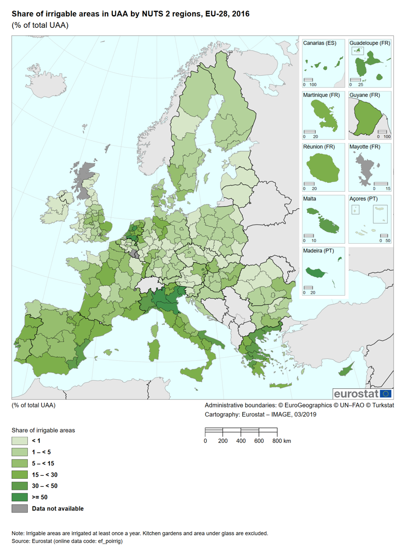
The indicator assesses the trend of the irrigable and irrigated areas and their share of the total utilised agricultural area (UAA). The irrigable area is the area which is equipped for irrigation. This area does not show so much variation from year to year as it is costly for the farmer to invest in irrigation equipment. The irrigated area measures the actual amount of land irrigated and can vary significantly from year to year due to, for instance, meteorological conditions or the choice of crop.