 Stars4Water
Irrigation
Type of resources
Available actions
Topics
Keywords
Contact for the resource
Provided by
Formats
Representation types
Update frequencies
status
Scale
-
This map shows the extent of land area equipped for irrigation -expressed as percentage- around the turn of the 20th century according to the Global Map of Irrigation Areas (version 4.0.1), together with areas of rainfed agriculture. Data are available from AQUASTAT - programme of the Land and Water Division of the Food and Agriculture Organization of the United Nations.
-
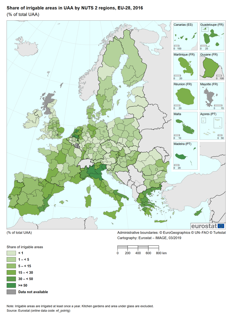
The indicator assesses the trend of the irrigable and irrigated areas and their share of the total utilised agricultural area (UAA). The irrigable area is the area which is equipped for irrigation. This area does not show so much variation from year to year as it is costly for the farmer to invest in irrigation equipment. The irrigated area measures the actual amount of land irrigated and can vary significantly from year to year due to, for instance, meteorological conditions or the choice of crop.