 Stars4Water
elevation
Type of resources
Available actions
Topics
Keywords
Contact for the resource
Provided by
Years
Formats
Representation types
Update frequencies
status
Scale
-
This raster layer represents the hill shade model within the Okavango Basin. Source: Data generated under the GIS EPSMO program (base:OB_DTM). This dataset is part of the GIS Database for the Environment Protection and Sustainable Management of the Okavango River Basin project (EPSMO). Detailed information on the database can be found in the “GIS Database for the EPSMO Project†document produced by Luis Veríssimo (FAO consultant) in July 2009, and here available for download.
-
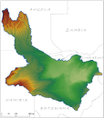
Digital Terrain Model within the Okavango Basin. Source: Data generated under the GIS EPSMO program (base:SRTM data). This dataset is part of the GIS Database for the Environment Protection and Sustainable Management of the Okavango River Basin project (EPSMO). Detailed information on the database can be found in the “GIS Database for the EPSMO Project†document produced by Luis Veríssimo (FAO consultant) in July 2009, and here available for download.
-
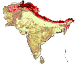
Derived from the Global Agro-Ecological Zones Study, Food and Agriculture Organization of the United Nations (FAO), Land and Water Development Division (AGL) with the collaboration of the International Institute for Applied Systems Analysis (IIASA), 2000. Two sources of geo-referenced terrain slopes were available for use in the Global AEZ assessment: (i) terrain slopes indicated in the mapping unit expansion tables of the respective soil maps, and (ii) terrain slopes derived from GTOPO30 data (EROS Data Center, 1998). The latter terrain-slope database was established at IIASA using a rule-based algorithm to calculate slope distributions in terms of seven slope classes per 5 minute grid-cell of the DSMW soil data based on neighborhood relationships among grid-cells in the 30 arc-second GTOPO30 database. Slopes derived from the 30 arc-second DEM were allocated to soil units occurring within individual soil associations. This involved five steps: (i) Determination of slope classes for each 30 arc-second grid-cell of GTOPO30. Results are grouped in the following seven classes: 0-2%, 2-5%, 5-8%, 8-16%, 16-30%, 30-45% and > 45%; (ii) Aggregation of the results respectively to 5 minute latitude/longitude DSMW grid-cells, and to individual soil association map units resulting in a slope class distribution for each grid-cell and map unit; (iii) Defining priority classes of soil unit/slope relationships; (iv) Establishing for each soil association consistent rankings of slopes/soil units; (v) Allocation of individual soil units within a particular soil association map unit to 5 min grid-cells of the DSMW, according to calculated slope distributions.
-
The Food and Agriculture Organization of the United Nations (FAO) with the collaboration of the International Institute for Applied Systems Analysis (IIASA), has developed a system that enables rational land-use planning on the basis of an inventory of land resources and evaluation of biophysical limitations and potentials. This is referred to as the Agro-ecological Zones (AEZ) methodology.
-
As part of the the World Bank's review of its rural development strategy, the Bank sought the assistance of the Food and Agriculture Organization of the United Nations (FAO) in evaluating how farming systems might change and adapt over the next thirty years. Amongst other objectives, the World Bank asked FAO to provide guidance on priorities for investment in food security, poverty reduction, and economic growth, and in particular to identify promising approaches and technologies that will contribute to these goals. The results of the study are summarized in a set of seven documents, comprising six regional reports and the global overview contained in this volume. This document, which synthesises the results of the six regional analyses as well as discussing global trends, cross-cutting issues and possible implementation modalities, presents an overview of the complete study. This document is supplemented by two case study reports of development issues of importance to farming systems globally.
-
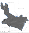
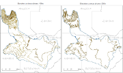
Elevation points in meters within the Okavango Basin. Source: Generated under the GIS EPSMO program, by vectorization of existing topographic maps at 1/1 000 000. This dataset is part of the GIS Database for the Environment Protection and Sustainable Management of the Okavango River Basin project (EPSMO). Detailed information on the database can be found in the “GIS Database for the EPSMO Project†document produced by Luis Veríssimo (FAO consultant) in July 2009, and here available for download.
-
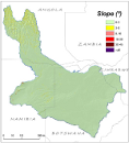
This raster layer represents the slope model within the Okavango Basin. Source: Data generated under the GIS EPSMO program (base:OB_DTM). This dataset is part of the GIS Database for the Environment Protection and Sustainable Management of the Okavango River Basin project (EPSMO). Detailed information on the database can be found in the “GIS Database for the EPSMO Project†document produced by Luis Veríssimo (FAO consultant) in July 2009, and here available for download.
-

This raster layer is the hill shade in the CORB-contributing area, in the reference scale of 1/200 000. It was created by interpolation of the DTM model with 90m pixel resolution. This dataset is part of the GIS Database for the Environment Protection and Sustainable Management of the Okavango River Basin project (EPSMO). Detailed information on the database can be found in the “GIS Database for the EPSMO Project†document produced by Luis Veríssimo (FAO consultant) in July 2009, and here available for download.
-
A set of 2 vector layers representing the contour lines at every 100m and 200m within the Okavango Basin. Source: Contour 100m generated under the GIS EPSMO program, by interpolation of the DTM model, and further operations of smoothing tolerance. Contour 200m generated under the GIS EPSMO program, by vectorization of existing topographic maps at 1/1 000 000. This dataset is part of the GIS Database for the Environment Protection and Sustainable Management of the Okavango River Basin project (EPSMO). Detailed information on the database can be found in the “GIS Database for the EPSMO Project†document produced by Luis Veríssimo (FAO consultant) in July 2009, and here available for download.