 Stars4Water
Farming
Type of resources
Available actions
Topics
Keywords
Contact for the resource
Provided by
Years
Formats
Representation types
Update frequencies
status
Scale
Resolution
-
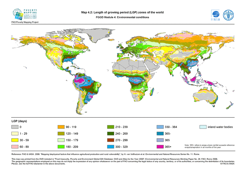
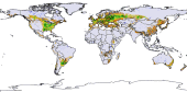
The FGGD LGP zone map is a global raster datalayer with a resolution of 5 arc-minutes. Each pixel contains a class value for the dominant LGP zone found in the pixel. The data are from FAO and IIASA, 2000, Global agro-ecological zones, as reported in FAO and IIASA, 2007, Mapping biophysical factors that influence agricultural production and rural vulnerability, by H. von Velthuizen et al.
-
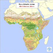
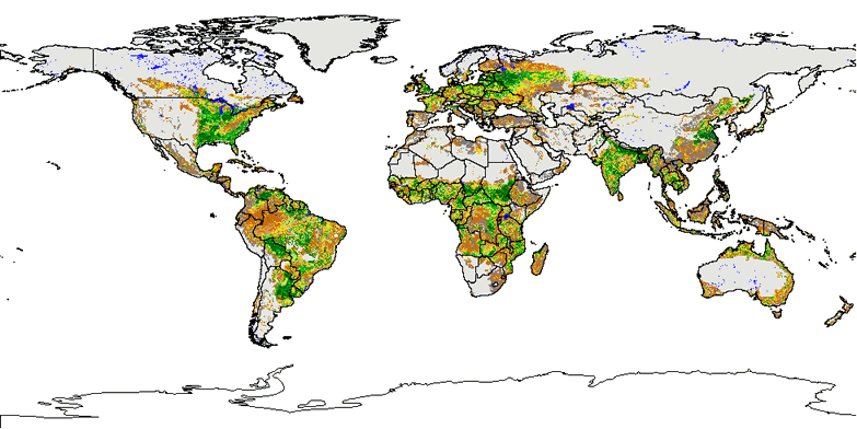
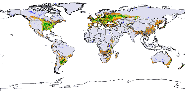
Eco-climatic zones were produced taking into account land-surface and atmospheric characteristics (the photosynthetic activity, the temperature of the earth?s surface, the atmospheric drying power, the rainfall, the potential evapotranspiration, the length of growing period for plants, the surface elevation). Most of these features could be accurately predicted using satellite data; some others needed a combination of remotely sensed and ground-based data. Remotely sensed data were acquired by NOAA-AVHRR sensor and by Meteosat satellite. The AVHRR satellite data were available in dekadal images for a 13 year series from 1982-1994. Meteosat imagery runs from 1988 to 1997. The information layer was produced for FAO in January 1999 by Environmental Research Group Oxford (ERGO Ltd) in collaboration with the Trypanosomosis and Land Use in Africa (TALA) research group at the Department of Zoology, University of Oxford.
-
The Food and Agriculture Organization of the United Nations (FAO) with the collaboration of the International Institute for Applied Systems Analysis (IIASA), has developed a system that enables rational land-use planning on the basis of an inventory of land resources and evaluation of biophysical limitations and potentials. This is referred to as the Agro-ecological Zones (AEZ) methodology.
-
The Food and Agriculture Organization of the United Nations (FAO) with the collaboration of the International Institute for Applied Systems Analysis (IIASA), has developed a system that enables rational land-use planning on the basis of an inventory of land resources and evaluation of biophysical limitations and potentials. This is referred to as the Agro-ecological Zones (AEZ) methodology.